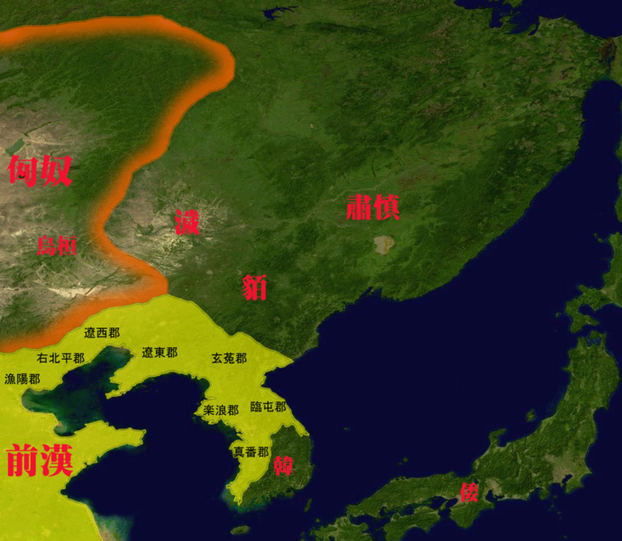
tóng-àn:Map of The east barbarian 0.png
跳至導覽
跳至搜尋

先看佔量: 690 × 600 像素. 其他的 kái-sek-tō͘: 276 × 240 像素 | 552 × 480 像素 | 884 × 768 像素 | 1,077 × 936 像素.
全解析度 (1,077 × 936 像素,檔案佔量: 469 KB,MIME類型: image/png)
檔案歷史
揤日期/時間,看彼時陣的檔案.
| 日期/ 時間 | 細張圖 | 寸尺 | 用者 | 註解 | |
|---|---|---|---|---|---|
| 現在 | 2010年10月19日 (拜2) 07:05 |  | 1,077 × 936(469 KB) | wikimediacommons>トムル | {{Information |Description={{ja|1=紀元前1世紀頃の東夷諸国。}} |Source=File:Whole world - land and oceans.jpg |Author=トムル |Date=2010.10.19 |Permission= |other_versions= }} Category:Maps of Manchuria Category:Maps of East Asia |