tóng-àn:Alabama Locator Map.PNG
跳至導覽
跳至搜尋


無較權的解析度.
Alabama_Locator_Map.PNG (225 × 348 像素,檔案佔量: 9 KB,MIME類型: image/png)
|
|
這是對Wikimedia Commons引來的一份檔案。伊佇hia ê kì-su̍t-ia̍h頂面的資訊顯示對下底. |

|
File:USA Alabama location map.svg是本檔案的向量版本。 如果品質不低,就應該優先使用該檔案,而非PNG檔案。
File:Alabama Locator Map.PNG → File:USA Alabama location map.svg
更多資訊請參閱Help:SVG/zh。 |
 |
Khài-iàu
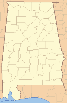
| Soat-bêng | Locator Map of Alabama, United States |
| Ji̍t-kî | |
| Chhut-chhù | taken from US Census website [1] and modified by User:Ruhrfisch |
| Chok-chiá | US Census, Ruhrfisch |
| 授權允准 (Bô siŏh-huòi sāi ciā ùng-giông) |
US Census / US Government work is public domain, my modifications licensed under the GNU Free Documentation License |
Siū-khoân
I, Ruhrfisch,此作品的版權所有人,決定用以下授權條款發佈本作品:

|
已授權您依據自由軟體基金會發行的無固定段落、封面文字和封底文字GNU自由文件授權條款1.2版或任意後續版本,對本檔進行複製、傳播和/或修改。該協議的副本列在GNU自由文件授權條款中。 |
| 此檔案採用創用CC 姓名標示-相同方式分享 3.0 未在地化版本授權條款。 | ||
| Biĕu-sê miàng-sáng: I, Ruhrfisch | ||
| ||
| 已新增授權條款標題至此檔案,作為GFDL授權更新的一部份。 |
此檔案採用創用CC 姓名標示-相同方式分享 2.5 通用版授權條款。
Biĕu-sê miàng-sáng: I, Ruhrfisch
- 你會使自由:
- 分享 – kho͘-pih, hoat-pò͘ kap thoân-pò͘ pún chok
- 重新修改 – kái-pian pún chok-phín
- Àn i-hā ê tiâu-kiāⁿ
- 標示名姓 – 您必須指名出正確的製作者,和提供授權條款的連結,以及表示是否有對內容上做出變更。您可以用任何合理的方式來行動,但不得以任何方式表明授權條款是對您許可或是由您所使用。
- 仝款方式方享 – Lí nā kái-tōng, piàn-khoán, he̍k-chiá kun-kù pún chok chhòng-chō, lí kaⁿ-taⁿ ē-tàng ēng kap pún chok kâng-khoán he̍k-chiá saⁿ-chhiūⁿ ê hí-khó lâi hoat-pò͘ chò--chhut-lâi ê chok-phín.
Nṳ̄ buóh dĭk sié-nó̤h sêu-guòng dèu-kuāng dŭ kō̤-ī gēng.
and
This image or file is a work of a United States Census Bureau employee, taken or made as part of that person's official duties. As a work of the U.S. federal government, the image is in the public domain.
|
 |
檔案歷史
揤日期/時間,看彼時陣的檔案.
| 日期/ 時間 | 細張圖 | 寸尺 | 用者 | 註解 | |
|---|---|---|---|---|---|
| 現在 | 2007年7月26日 (拜4) 10:44 | | 225 × 348(9 KB) | Ruhrfisch | {{Information| |Description= Locator Map of Alabama, United States |Source= taken from US Census website [http://factfinder.census.gov/] and modified by User:Ruhrfisch |Date= July 2007 |Author= US Census, Ruhrfisch |Permission= US Census / US Governm |
影像連結
無半頁連到這張影像.