tóng-àn:Austro-Hungarian Monarchy (1914).svg
跳至導覽
跳至搜尋


此 SVG 檔案的 PNG 預覽的大小:450 × 456 像素。 其他的 kái-sek-tō͘: 237 × 240 像素 | 474 × 480 像素 | 592 × 600 像素 | 758 × 768 像素 | 1,011 × 1,024 像素.
全解析度 (SVG ùng-giông, chék-cháung: 450 × 456 chuông-só, ùng-giông duâi-nâung:456 KB)
|
|
這是對Wikimedia Commons引來的一份檔案。伊佇hia ê kì-su̍t-ia̍h頂面的資訊顯示對下底. |
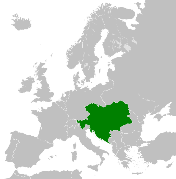
The map is false, Silesia the region in the southern Poland was never polish. The green map should also cover the Silesian land. Prove (do see the coat of arms, there you can see our coat of arms of all Silesians the black eagle with a silver gorget on his chest. Do not lie about our history!!!
Khài-iàu


.svg)
.svg)
.svg)
.svg)
.svg)


.svg)
.svg)
.svg)


.png)
.png)


.svg)


.svg)

.svg)


.svg)
.svg)
.svg)
.svg)


.svg)
.png)


.svg)


.svg)
.svg)


.svg)


.svg)


.svg)
.svg)
.svg)
.svg)
.svg)
.svg)
.svg)
.svg)
_cropped.svg)
.svg)
.svg)
.svg)
.svg)
.svg)
.svg)
.svg)
.svg)
.svg)
.svg)
.svg)
.svg)
.svg)
.svg)
.svg)
.svg)
.svg)
.svg)
.svg)
.svg)
.svg)
.svg)
.svg)
.svg)
.svg)
.svg)
.svg)
.svg)
.svg)
.svg)
.svg)
.svg)
.svg)
.svg)
.svg)
.svg)
.svg)
.svg)
.svg)
.svg)
.svg)
.svg)
.svg)
.svg)
.svg)
檔案歷史
揤日期/時間,看彼時陣的檔案.
| 日期/ 時間 | 細張圖 | 寸尺 | 用者 | 註解 | |
|---|---|---|---|---|---|
| 現在 | 2013年7月26日 (拜5) 01:34 | | 450 × 456(456 KB) | Alphathon | Removed Dutch polders (weren't completed until the mid 20th century) |
影像連結
以下的頁連到這个影像:
.svg)
.svg)
.svg&action=edit&redlink=1)
.svg&variant=nan)
.svg&variant=nan-hant)
.svg&variant=nan-hans-ruby)
.svg&variant=nan-hans)
.svg&action=edit)
.svg)
.svg&printable=yes)
.svg&action=info)
.svg&mobileaction=toggle_view_mobile)