tóng-àn:Bailu 2019 track.png
跳至導覽
跳至搜尋

先看佔量: 800 × 495 像素. 其他的 kái-sek-tō͘: 320 × 198 像素 | 640 × 396 像素 | 1,024 × 633 像素 | 1,280 × 791 像素 | 2,700 × 1,669 像素.
全解析度 (2,700 × 1,669 像素,檔案佔量: 2.43 MB,MIME類型: image/png)
|
|
這是對Wikimedia Commons引來的一份檔案。伊佇hia ê kì-su̍t-ia̍h頂面的資訊顯示對下底. |
Khài-iàu
| Soat-bêng |
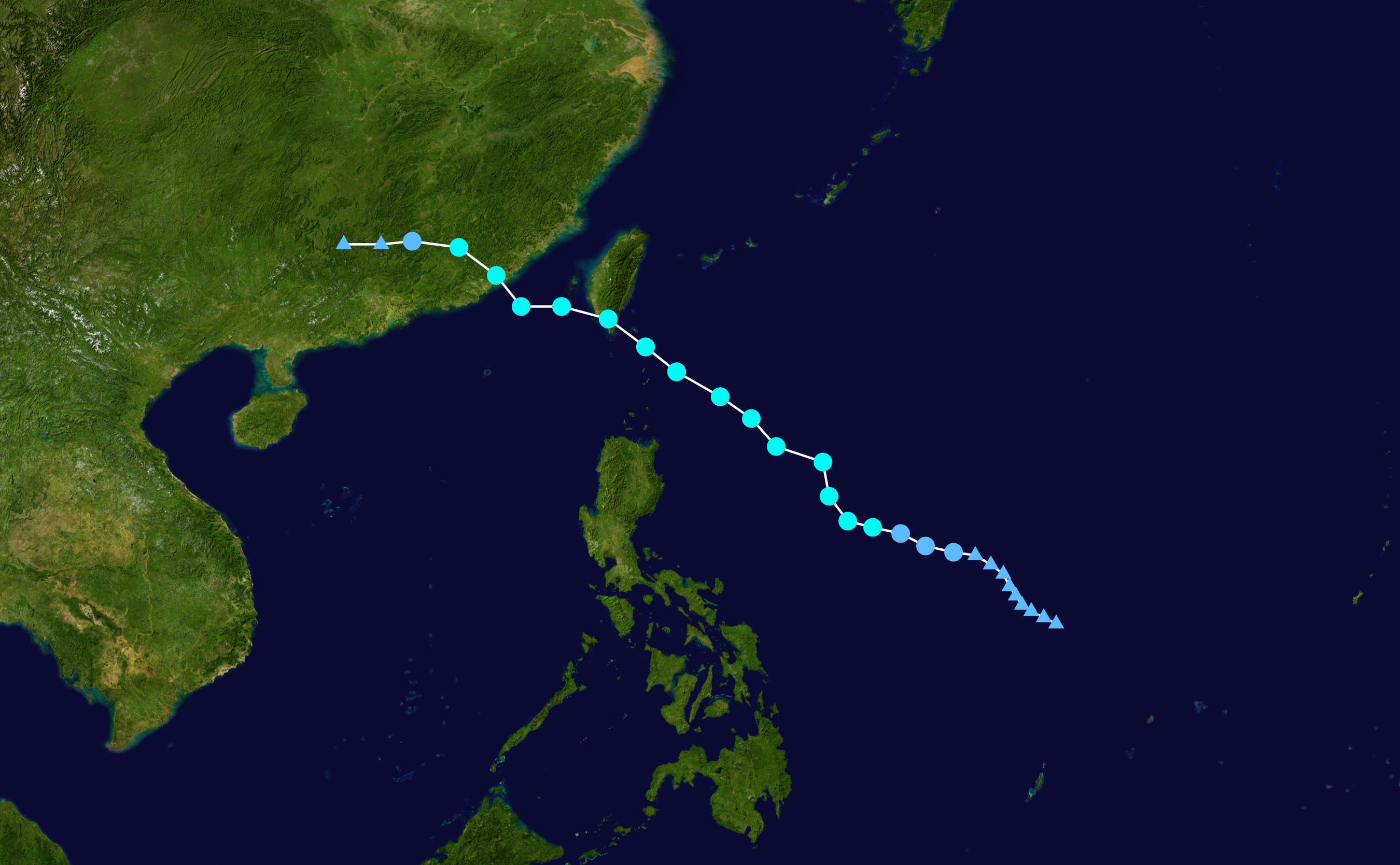
English: Track map of Severe Tropical Storm Bailu of the 2019 Pacific typhoon season. The points show the location of the storm at 6-hour intervals. The colour represents the storm's maximum sustained wind speeds as classified in the (see below), and the shape of the data points represent the nature of the storm, according to the legend below. Tropical depression (≤38 mph, ≤62 km/h)
Tropical storm (39–73 mph, 63–118 km/h)
Category 1 (74–95 mph, 119–153 km/h)
Category 2 (96–110 mph, 154–177 km/h)
Category 3 (111–129 mph, 178–208 km/h)
Category 4 (130–156 mph, 209–251 km/h)
Category 5 (≥157 mph, ≥252 km/h)
Unknown
Storm type |
||
| Ji̍t-kî | 2019-08-19–2019-08-26 | ||
| Chhut-chhù | Created by Meow using Wikipedia:WikiProject Tropical cyclones/Tracks. The background image is from NASA. Tracking data is from the Joint Typhoon Warning Center[1]. | ||
| Chok-chiá | Meow | ||
| Source code | Track map data table, if present below, is in HURDAT2 or ATCF format. See format details in [2] and [3], respectively.
|
Siū-khoân
| 此作品已由其作者,Meow,釋出至公有領域。此授權條款在全世界均適用。 這可能在某些國家不合法,如果是的話: Meow授予任何人有權利使用此作品於任何用途,除受法律約束外,不受任何限制。 |
檔案歷史
揤日期/時間,看彼時陣的檔案.
| 日期/ 時間 | 細張圖 | 寸尺 | 用者 | 註解 | |
|---|---|---|---|---|---|
| 現在 | 2020年9月16日 (拜3) 14:14 | | 2,700 × 1,669(2.43 MB) | Meow | JTWC best track data |
影像連結
以下的頁連到這个影像: