tóng-àn:Cordova Alaska aerial view.jpg
跳至導覽
跳至搜尋

先看佔量: 635 × 600 像素. 其他的 kái-sek-tō͘: 254 × 240 像素 | 508 × 480 像素 | 813 × 768 像素 | 1,084 × 1,024 像素 | 1,500 × 1,417 像素.
全解析度 (1,500 × 1,417 像素,檔案佔量: 821 KB,MIME類型: image/jpeg)
|
|
這是對Wikimedia Commons引來的一份檔案。伊佇hia ê kì-su̍t-ia̍h頂面的資訊顯示對下底. |
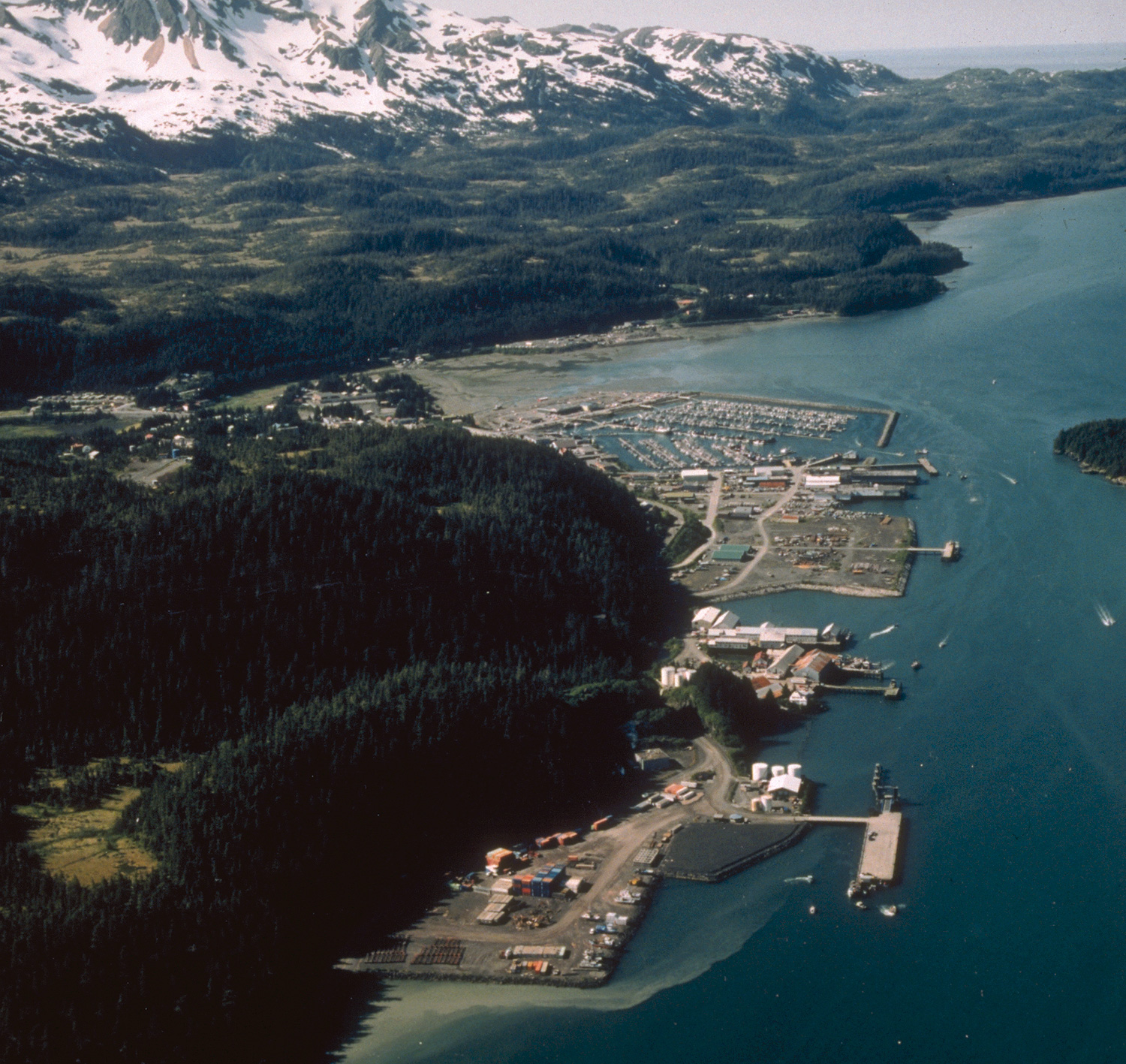
| Soat-bêng | Aerial view of Cordova, Alaska. | |||
| 圖中地點 | Cordova, Alaska, USA 60°32′58.64″N 145°45′50.34″W / 60.5496222°N 145.7639833°W |
|||
| Ji̍t-kî | not specified or unknown | |||
| Chhut-chhù |
U.S. Army Corps of Engineers Digital Visual Library Image page Image description page Digital Visual Library home page |
|||
| Chok-chiá | U.S. Army Corps of Engineers, photographer not specified or unknown | |||
| 授權允准 (Bô siŏh-huòi sāi ciā ùng-giông) |
|
檔案歷史
揤日期/時間,看彼時陣的檔案.
| 日期/ 時間 | 細張圖 | 寸尺 | 用者 | 註解 | |
|---|---|---|---|---|---|
| 現在 | 2007年3月20日 (拜2) 09:28 | | 1,500 × 1,417(821 KB) | DanMS | Whoops! Uploaded wrong picture last time. |
影像連結
以下的頁連到這个影像: