tóng-àn:Depere Dam Depere Wisconsin.jpg
跳至導覽
跳至搜尋

先看佔量: 800 × 561 像素. 其他的 kái-sek-tō͘: 320 × 224 像素 | 640 × 448 像素 | 1,024 × 717 像素 | 1,280 × 897 像素 | 1,500 × 1,051 像素.
全解析度 (1,500 × 1,051 像素,檔案佔量: 535 KB,MIME類型: image/jpeg)
|
|
這是對Wikimedia Commons引來的一份檔案。伊佇hia ê kì-su̍t-ia̍h頂面的資訊顯示對下底. |
| Soat-bêng |
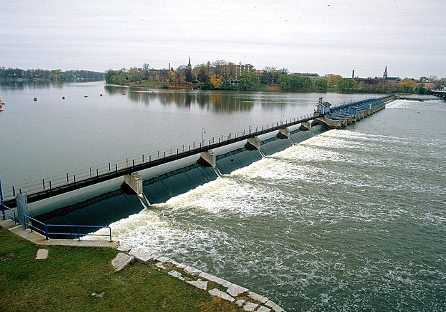
English: De Pere Dam on the Fox River at De Pere, Brown County, Wisconsin, USA. The dam is at the site of the original Rapides Des Pères (Rapids of the Fathers), the last set of rapids on the Fox River before it enters Green Bay. |
|||
| Ji̍t-kî | not specified or unknown, but taken before 2007 as a white bridge now spans the river near the location of the orange buoys. | |||
| Chhut-chhù |
U.S. Army Corps of Engineers Digital Visual Library Image page Image description page Digital Visual Library home page |
|||
| Chok-chiá | U.S. Army Corps of Engineers, photographer not specified or unknown | |||
| Siū-khuân ún-tsún (Koh iōng tsit-ê tóng-àn) |
|
|||
| 圖中地點 | Depere, Wisconsin, USA |
| 拍攝地點 | | 位於此地的本圖片與其他圖片: OpenStreetMap |
|---|
檔案歷史
揤日期/時間,看彼時陣的檔案.
| 日期/ 時間 | 細張圖 | 寸尺 | 用者 | 註解 | |
|---|---|---|---|---|---|
| 現在 | 2007年3月29日 (拜4) 03:32 | | 1,500 × 1,051(535 KB) | wikimediacommons>DanMS | {{Information | Description = {{en|Depere Dam on the Fox River at Depere, Brown County, Wisconsin, USA. The dam is at the site of the original ''Rapides Des Pères'' (Rapids of the Fathers), the last set of rapids on the Fox River before it enters Gree |
影像連結
以下的頁連到這个影像: