tóng-àn:Fiji map.png
跳至導覽
跳至搜尋
無較權的解析度.
Fiji_map.png (324 × 349 像素,檔案佔量: 11 KB,MIME類型: image/png)
|
|
這是對Wikimedia Commons引來的一份檔案。伊佇hia ê kì-su̍t-ia̍h頂面的資訊顯示對下底. |

|
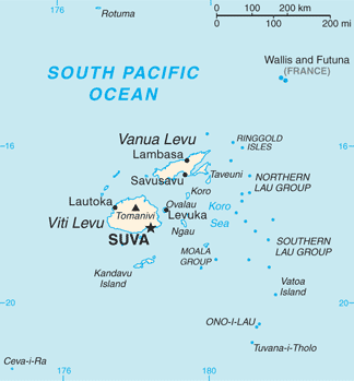
This map has been uploaded by Electionworld from en.wikipedia.org to enable the |
PNG map of Fiji from CIA World Factbook.
|
|
 |
Originally uploaded to English Wikipedia by en:User:Grendelkhan as Fj-map.png.

|
本圖片是以PNG、GIF或JPEG格式上傳。然而,其中包含的資料或訊息,應該重新建立成可縮放向量圖形(SVG)檔案,以更有效率或更準確的方式儲存。如有可能,請上傳本圖片的SVG格式版本。在上傳之後,請修改維基各姊妹計畫中所有使用舊版圖片的條目(列在圖像連結章節中),替換為新版圖片,並在舊圖片的描述頁中加入{{Vector version available|新圖片名稱.svg}}模板,同時移除本模板。
|
檔案歷史
揤日期/時間,看彼時陣的檔案.
| 日期/ 時間 | 細張圖 | 寸尺 | 用者 | 註解 | |
|---|---|---|---|---|---|
| 現在 | 2013年5月1日 (拜3) 21:26 | | 324 × 349(11 KB) | Ras67 | cropped |
影像連結
以下的頁連到這个影像: