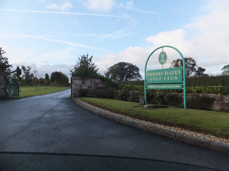
tóng-àn:Golf course entrance - geograph.org.uk - 2662727.jpg
Golf_course_entrance_-_geograph.org.uk_-_2662727.jpg (800 × 600 像素,檔案佔量: 375 KB,MIME類型: image/jpeg)
|
|
這是對Wikimedia Commons引來的一份檔案。伊佇hia ê kì-su̍t-ia̍h頂面的資訊顯示對下底. |
Bo̍k-lo̍k
Khài-iàu
| Soat-bêngGolf course entrance - geograph.org.uk - 2662727.jpg |
English: Golf course entrance, CTYPE html PUBLIC "-//W3C//DTD XHTML 1.0 Strict//EN"
"http://www.w3.org/TR/xhtml1/DTD/xhtml1-strict.dtd"> <html xmlns="http://www.w3.org/1999/xhtml" xml:lang="en" id="geograph"> <head> <title>Golf course entrance:: OS grid SJ5166 :: Geograph Britain and Ireland - photograph every grid square!</title> <meta http-equiv="Content-Type" content="text/html; charset=iso-8859-1" /> <meta name="description" content="SJ5166 :: Golf course entrance, near to Oscroft, Cheshire, Great Britain" /> <meta name="ICBM" content="53.193678810942, -2.7341189354831"/> <meta name="DC.title" content="Geograph:: Golf course entrance:: OS grid SJ5166"/> <meta property="og:image" content="http://s0.geograph.org.uk/geophotos/02/66/27/2662727_7525a812.jpg"/> <link rel="stylesheet" type="text/css" title="Monitor" href="http://s1.geograph.org.uk/templates/basic/css/basic.v7747.css" media="screen" /> <link rel="shortcut icon" type="image/x-icon" href="http://s1.geograph.org.uk/favicon.ico"/> <link rel="alternate" type="application/vnd.google-earth.kml+xml" href="/photo/2662727.kml"/> <link rel="search" type="application/opensearchdescription+xml" title="Geograph Britain and Ireland search" href="/stuff/osd.xml" /> <script type="text/javascript" src="http://s1.geograph.org.uk/js/geograph.v7635.js"></script> </head> <body> <a title="Geograph home page" href="/">Geograph - photograph every grid square</a><a title="Grid Reference SJ5166 :: 6 images" href="/gridref/SJ5166">SJ5166</a> : Golf course entrancenear to Oscroft, Cheshire, Great Britain. |
| Ji̍t-kî | |
| Chhut-chhù | From geograph.org.uk; transferred by User:Skinsmoke using geograph_org2commons. |
| Chok-chiá | David Smith |
| Siū-khuân ún-tsún (Koh iōng tsit-ê tóng-àn) |
Creative Commons Attribution Share-alike license 2.0 |
| Piau-sī miâ-sìnn (由许可协议要求) InfoField | David Smith / Golf course entrance / |
InfoField | David Smith / Golf course entrance |
| 拍攝地點 | 53° 11′ 38.21″ 北, 2° 44′ 02.85″ 西 | 位於此地的本圖片與其他圖片: OpenStreetMap |
|---|
| 目標地點 | 53° 11′ 37.4″ 北, 2° 44′ 02″ 西 | 位於此地的本圖片與其他圖片: OpenStreetMap |
|---|
Siū-khoân

|
- Lí ē-sái tsū-iû:
- hun-hióng – kho͘-pih, hoat-pò͘ kap thoân-pò͘ pún chok
- tiông-sin siu-kái – kái-pian pún chok-phín
- Àn i-hā ê tiâu-kiāⁿ
- Piau-sī miâ-sìnn – Lí ài siá-bîng tsìng-khak ê miâ-hō, ū siū-khuân tiâu-khuán ê liân-kiat, iáu-koh-ū lí tsuè siánn-mih ê kái-piàn. Lí ē-tàng tī jīm-hô ha̍p-lí ê hong-sik tsìn-hîng, m̄-kò buē-tàng ti̍t-tsiap kóng siū-khuân hōo lí ia̍h-sī lí sú-iōng.
- Kâng-khuán hong-sik hun-hióng – Lí nā kái-tōng, piàn-khoán, he̍k-chiá kun-kù pún chok chhòng-chō, lí kaⁿ-taⁿ ē-tàng ēng kap pún chok kâng-khoán he̍k-chiá saⁿ-chhiūⁿ ê hí-khó lâi hoat-pò͘ chò--chhut-lâi ê chok-phín.
說明
在此檔案描寫的項目
描繪內容 繁體中文
授權條款 繁體中文
檔案來源 Chinese (Taiwan) (已轉換拼寫)
20 10 2011
攝影器材 繁體中文
檔案歷史
揤日期/時間,看彼時陣的檔案.
| 日期/ 時間 | 細張圖 | 寸尺 | 用者 | 註解 | |
|---|---|---|---|---|---|
| 現在 | 2013年5月16日 (拜4) 00:31 |  | 800 × 600(375 KB) | wikimediacommons>File Upload Bot (Magnus Manske) |
影像連結
以下的頁連到這个影像:
元資料
這个檔案有伊的資訊,可能是相機抑掃描機用的。
若改過這个檔案,資訊就無完全對著。
| 相機製造商 | FUJIFILM |
|---|---|
| 相機型號 | FinePix F550EXR |
| 方位 | 標準 |
| 水平解像度 | 72 dpi |
| 垂直解像度 | 72 dpi |
| 使用的軟體 | Digital Camera FinePix F550EXR Ver1.13 |
| 檔案改變的日子佮時間 | 2011年10月20日 (拜4) 09:15 |
| 亮度與彩度位置 | 同時取樣 |
| 曝光時間 | 1/300 秒 (0.0033333333333333) |
| 光圈值 | f/7.1 |
| 曝光模式 | 標準模式 |
| ISO 速率 | 400 |
| Exif 版本 | 2.3 |
| 資料產生的日期時間 | 2011年10月20日 (拜4) 09:15 |
| 數位化的日期時間 | 2011年10月20日 (拜4) 09:15 |
| 每像素內含 |
|
| 影像壓縮模式 | 2 |
| APEX 快門速度 | 8.21 |
| APEX 光圈 | 5.7 |
| APEX 亮度 | 7.74 |
| APEX 曝光補償 | 0 |
| 最大陸地光圈 | 3.6 APEX(f/3.48) |
| 測光模式 | 模式 |
| 光源 | 不明 |
| 閃光燈 | 閃光燈未開啟, 強制閃光燈關閉 |
| 焦距 | 4.4毫米 |
| 支援的 Flashpix 版本 | 1 |
| 色彩空間 | sRGB |
| X 軸焦平面解析度 | 7,166 |
| Y 軸焦平面解析度 | 7,166 |
| 焦平面解析度單位 | 3 |
| 感光模式 | 單晶片彩色區域感測器 |
| 檔案來源 | 數位相機 |
| 場景類型 | 直接照像圖片 |
| 自訂影像處理 | 一般程序 |
| 曝光模式 | 自動曝光 |
| 白平衡 | 自動白平衡 |
| 場景拍攝類型 | 標準 |
| 銳利度 | 標準 |
| 主體距離範圍 | 不明 |
