tóng-àn:Haute-Kotto sub-prefectures.png
跳至導覽
跳至搜尋

先看佔量: 776 × 600 像素. 其他的 kái-sek-tō͘: 311 × 240 像素 | 621 × 480 像素 | 994 × 768 像素 | 1,056 × 816 像素.
全解析度 (1,056 × 816 像素,檔案佔量: 25 KB,MIME類型: image/png)
|
|
這是對Wikimedia Commons引來的一份檔案。伊佇hia ê kì-su̍t-ia̍h頂面的資訊顯示對下底. |
Khài-iàu
| Soat-bêng |
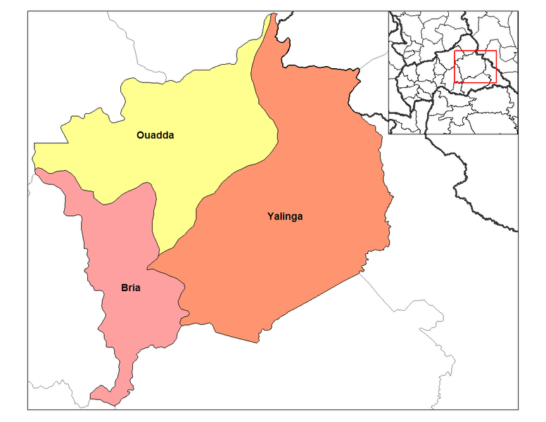
English: Map of the sub-prefectures of Haute-Kotto prefecture of the Central African Republic. Created by Rarelibra 19:46, 31 August 2006 (UTC) for public domain use, using MapInfo Professional v8.5 and various mapping resources. |
| Ji̍t-kî | 2006年8-goe̍h31日 (原始上傳日期) |
| Chhut-chhù |
Ka-tī chò--ê Transferred from en.wikipedia |
| Chok-chiá | Rarelibra at en.wikipedia |
Siū-khoân
| |
此作品已由其作者,中文Wikipedia專案的Rarelibra,釋出至公有領域。此授權條款在全世界均適用。 如果法律不適用時: |
原始上傳日誌
The original description page was here. All following user names refer to en.wikipedia.
- 2006-08-31 19:46 Rarelibra 1056×816 (25873 bytes) Map of the sub-prefectures of Haute-Kotto prefecture of the Central African Republic. Created by ~~~~ for public domain use, using MapInfo Professional v8.5 and various mapping resources.
檔案歷史
揤日期/時間,看彼時陣的檔案.
| 日期/ 時間 | 細張圖 | 寸尺 | 用者 | 註解 | |
|---|---|---|---|---|---|
| 現在 | 2012年1月29日 (禮拜) 23:17 | | 1,056 × 816(25 KB) | BotMultichillT | {{BotMoveToCommons|en.wikipedia|year={{subst:CURRENTYEAR}}|month={{subst:CURRENTMONTHNAME}}|day={{subst:CURRENTDAY}}}} == {{int:filedesc}} == {{Information |description={{en|1=Map of the sub-prefectures of Haute-Kotto prefecture of the Central African Re |
影像連結
以下的頁連到這个影像: