tóng-àn:Havre De Grace Maryland Lighthouse 600.jpg
Havre_De_Grace_Maryland_Lighthouse_600.jpg (400 × 600 像素,檔案佔量: 99 KB,MIME類型: image/jpeg)
|
|
這是對Wikimedia Commons引來的一份檔案。伊佇hia ê kì-su̍t-ia̍h頂面的資訊顯示對下底. |
Khài-iàu
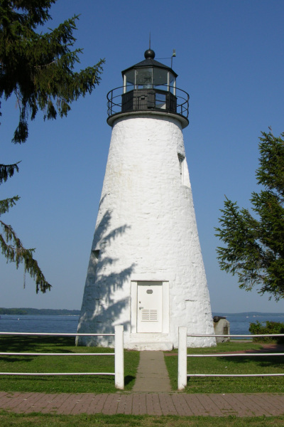
Picture of the Concord Point Lighthouse in Havre De Grace, Maryland overlooking the point where the Susquehanna River flows into the Chesapeake Bay. Photo by Derek Ramsey (Ram-Man)
Siū-khoân
You may NOT use this image on your own web site or anywhere else unless you release this image and any derivative works (which may include the web page or other medium where this image is used, if it is not considered a "collective work") by following the terms of one of the following licenses. Any other use will be considered a breach of copyright law. Please do not copy this image illegally by ignoring the terms of the license, as it is not in the public domain.
If you would like special permission to use, license, or purchase the image or prints of the image, or for use in any other fashion, or would simply like a copy of the original file, please contact me or email me first to ask. Please see the non-legalese usage guide for more information.
Note: While you are not required to do so by the license, please consider letting me know when you reuse one of my photograph images, as a courtesy.

|
已授權您依據自由軟體基金會發行的無固定段落、封面文字和封底文字GNU自由文件授權條款1.2版(不含其他版本),對本檔進行複製、傳播和/或修改。該協議的副本列在GNU自由文件授權條款中。 | 僅1.2版 |
- Lí ē-sái tsū-iû:
- hun-hióng – kho͘-pih, hoat-pò͘ kap thoân-pò͘ pún chok
- tiông-sin siu-kái – kái-pian pún chok-phín
- Àn i-hā ê tiâu-kiāⁿ
- Piau-sī miâ-sìnn – Lí ài siá-bîng tsìng-khak ê miâ-hō, ū siū-khuân tiâu-khuán ê liân-kiat, iáu-koh-ū lí tsuè siánn-mih ê kái-piàn. Lí ē-tàng tī jīm-hô ha̍p-lí ê hong-sik tsìn-hîng, m̄-kò buē-tàng ti̍t-tsiap kóng siū-khuân hōo lí ia̍h-sī lí sú-iōng.
- Kâng-khuán hong-sik hun-hióng – Lí nā kái-tōng, piàn-khoán, he̍k-chiá kun-kù pún chok chhòng-chō, lí kaⁿ-taⁿ ē-tàng ēng kap pún chok kâng-khoán he̍k-chiá saⁿ-chhiūⁿ ê hí-khó lâi hoat-pò͘ chò--chhut-lâi ê chok-phín.
| 目標地點 | | 位於此地的本圖片與其他圖片: OpenStreetMap |
|---|
檔案歷史
揤日期/時間,看彼時陣的檔案.
| 日期/ 時間 | 細張圖 | 寸尺 | 用者 | 註解 | |
|---|---|---|---|---|---|
| 現在 | 2005年7月17日 (禮拜) 03:54 | | 400 × 600(99 KB) | wikimediacommons>Ram-Man | Picture of the Lighthouse in Havre De Grace, Maryland overlooking the point where the Susquehanna River flows into the Chesapeake Bay. Photo by Derek Ramsey ([[w |
影像連結
以下的頁連到這个影像: