tóng-àn:Holy Cross Church, Burley on the Hill - geograph.org.uk - 1596761.jpg
跳至導覽
跳至搜尋


先看佔量: 450 × 600 像素. 其他的 kái-sek-tō͘: 180 × 240 像素 | 480 × 640 像素.
全解析度 (480 × 640 像素,檔案佔量: 93 KB,MIME類型: image/jpeg)
|
|
這是對Wikimedia Commons引來的一份檔案。伊佇hia ê kì-su̍t-ia̍h頂面的資訊顯示對下底. |
Khài-iàu
| Soat-bêng |
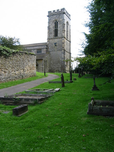
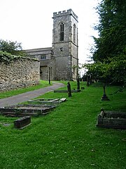
English: Holy Cross parish church (NOT All Saints!), Burley-on-the-Hill, Rutland, England |
| Ji̍t-kî | |
| Chhut-chhù | From geograph.org.uk; transferred by User:Peter I. Vardy using geograph_org2commons. |
| Chok-chiá | Kate Jewell |
| 授權允准 (Bô siŏh-huòi sāi ciā ùng-giông) |
Creative Commons Attribution Share-alike license 2.0 |
| Biĕu-sê miàng-sáng (由许可协议要求) | Kate Jewell / All Saints Church, Burley on the Hill / |
| 拍攝地點 | | 位於此地的本圖片與其他圖片: OpenStreetMap |
|---|
Siū-khoân

|
此檔案採用創用CC 姓名標示-相同方式分享 2.0 通用版授權條款。
Biĕu-sê miàng-sáng: Kate Jewell
- 你會使自由:
- 分享 – kho͘-pih, hoat-pò͘ kap thoân-pò͘ pún chok
- 重新修改 – kái-pian pún chok-phín
- Àn i-hā ê tiâu-kiāⁿ
- 標示名姓 – 您必須指名出正確的製作者,和提供授權條款的連結,以及表示是否有對內容上做出變更。您可以用任何合理的方式來行動,但不得以任何方式表明授權條款是對您許可或是由您所使用。
- 仝款方式方享 – Lí nā kái-tōng, piàn-khoán, he̍k-chiá kun-kù pún chok chhòng-chō, lí kaⁿ-taⁿ ē-tàng ēng kap pún chok kâng-khoán he̍k-chiá saⁿ-chhiūⁿ ê hí-khó lâi hoat-pò͘ chò--chhut-lâi ê chok-phín.
| Annotations | This image is annotated: View the annotations at Commons |
檔案歷史
揤日期/時間,看彼時陣的檔案.
| 日期/ 時間 | 細張圖 | 寸尺 | 用者 | 註解 | |
|---|---|---|---|---|---|
| 現在 | 2010年9月27日 (拜1) 01:44 | | 480 × 640(93 KB) | File Upload Bot (Magnus Manske) | == {{int:filedesc}} == {{Information |Description={{en|1=All Saints Church, Burley on the Hill, near to Burley, Rutland, Great Britain. The approach to the church at Burley is up a fairly steep path. The wall on the left is the boundary of Burley Hall gro |
影像連結
以下的頁連到這个影像: