tóng-àn:India satellite image.png
跳至導覽
跳至搜尋

先看佔量: 800 × 592 像素. 其他的 kái-sek-tō͘: 320 × 237 像素 | 640 × 474 像素 | 1,024 × 758 像素 | 1,278 × 946 像素.
全解析度 (1,278 × 946 像素,檔案佔量: 1.51 MB,MIME類型: image/png)
|
|
這是對Wikimedia Commons引來的一份檔案。伊佇hia ê kì-su̍t-ia̍h頂面的資訊顯示對下底. |
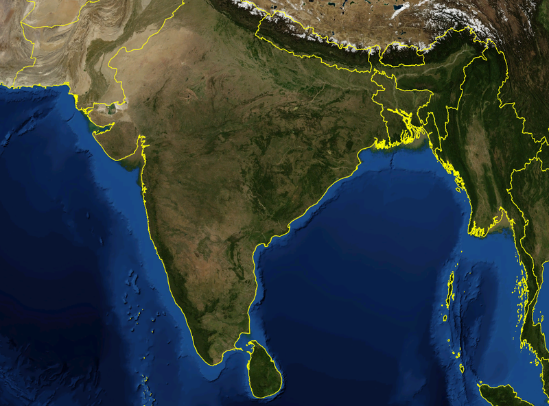
| Soat-bêng | Satellite image of India and surrounding regions | |||
| Ji̍t-kî | ||||
| Chhut-chhù | Ka-tī chò--ê | |||
| Chok-chiá | Mgiganteus | |||
| Siū-khuân ún-tsún (Koh iōng tsit-ê tóng-àn) |
|

| Annotations | This image is annotated: View the annotations at Commons |
檔案歷史
揤日期/時間,看彼時陣的檔案.
| 日期/ 時間 | 細張圖 | 寸尺 | 用者 | 註解 | |
|---|---|---|---|---|---|
| 現在 | 2007年11月28日 (拜3) 14:21 | | 1,278 × 946(1.51 MB) | wikimediacommons>Mgiganteus | {{Information |Description=Satellite image of India and surrounding regions |Source=self-made |Date=2007 |Author= Mgiganteus |Permission={{PD-WorldWind}} |other_versions= }} Category:Maps of India Category:South Asia [[Categor |
影像連結
以下的頁連到這个影像: