tóng-àn:Kaali crater.jpg

|
|
這是對Wikimedia Commons引來的一份檔案。伊佇hia ê kì-su̍t-ia̍h頂面的資訊顯示對下底. |
| Soat-bêng |
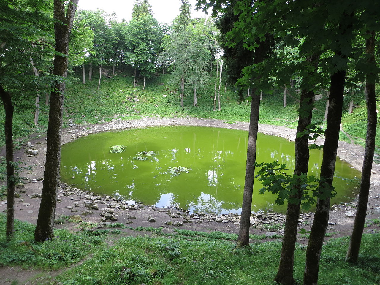
A green pool of water at the largest of the meteorite craters at Kaali on Saaremaa island in Estonia. The nine <a href="http://en.wikipedia.org/wiki/Kaali_crater" rel="nofollow">Kaali craters</a> were formed between 4,000 and 7,500 years ago by meteorite fragments from an iron meteor that broke up into multiple fragments 5-10 km above ground. The original meteor may have been up to 10,000 metric tonnes when it entered the atmosphere at a speed of 15-45 km/sec, but the fragment creating the main crater was only 20-80 tonne when it hit the ground at 10-20 km/sec. This was the last giant meteorite fall in a densely populated area, and it left traces in old European folklore (Edda and Kalevala) as well as in written sources (Pytheas and Scandinavian Sagas). [<a href="http://beer-trotter.blogspot.no/2013/11/a-couple-of-days-on-saaremaa.html" rel="nofollow">read more</a>] |
||
| Ji̍t-kî | |||
| Chhut-chhù | Flickr: Kaali crater | ||
| Chok-chiá | Bernt Rostad | ||
| 授權允准 (Bô siŏh-huòi sāi ciā ùng-giông) |
此檔案採用創用CC 姓名標示 2.0 通用版授權條款。
|
| 拍攝地點 | | 位於此地的本圖片與其他圖片: OpenStreetMap |
|---|
檔案歷史
揤日期/時間,看彼時陣的檔案.
| 日期/ 時間 | 細張圖 | 寸尺 | 用者 | 註解 | |
|---|---|---|---|---|---|
| 現在 | 2013年11月10日 (禮拜) 01:52 | | 4,000 × 3,000(4.03 MB) | Flickr upload bot | Uploaded from http://flickr.com/photo/67975030@N00/10542805205 using Flickr upload bot |
影像連結
以下的頁連到這个影像: