tóng-àn:Kivalina Alaska aerial view.jpg
跳至導覽
跳至搜尋

先看佔量: 800 × 600 像素. 其他的 kái-sek-tō͘: 320 × 240 像素 | 640 × 480 像素 | 1,024 × 768 像素 | 1,280 × 960 像素 | 1,500 × 1,125 像素.
全解析度 (1,500 × 1,125 像素,檔案佔量: 208 KB,MIME類型: image/jpeg)
|
|
這是對Wikimedia Commons引來的一份檔案。伊佇hia ê kì-su̍t-ia̍h頂面的資訊顯示對下底. |
| Soat-bêng |
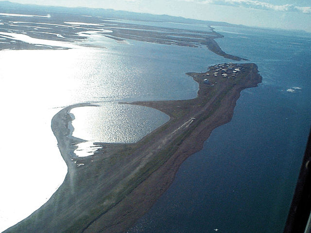
English: Aerial view of Kivalina, Alaska, USA. View is to the southeast. |
|||
| 圖中地點 | Kivalina, Alaska, USA 67°43′51.79″N 164°33′0.48″W / 67.7310528°N 164.5501333°W |
|||
| Ji̍t-kî | ||||
| Chhut-chhù |
U.S. Army Corps of Engineers Digital Visual Library Image page Image description page Digital Visual Library home page |
|||
| Chok-chiá | U.S. Army Corps of Engineers, photographer not specified or unknown | |||
| Siū-khuân ún-tsún (Koh iōng tsit-ê tóng-àn) |
|
| 目標地點 | | 位於此地的本圖片與其他圖片: OpenStreetMap |
|---|
檔案歷史
揤日期/時間,看彼時陣的檔案.
| 日期/ 時間 | 細張圖 | 寸尺 | 用者 | 註解 | |
|---|---|---|---|---|---|
| 現在 | 2007年3月21日 (拜3) 03:52 | | 1,500 × 1,125(208 KB) | wikimediacommons>DanMS | {{Information | Description = {{en|Aerial view of Kivalina, Alaska, USA. View is to the southeast.}} | Source = U.S. Army Corps of Engineers Digital Visual Library<br />[http://images.usace.army.mil/images/Hires/cepoa171.jpg Image page]<br />[h |
影像連結
以下的頁連到這个影像: