tóng-àn:Land surface temperature anomaly over East Asia in January 2016.jpg
跳至導覽
跳至搜尋
無較權的解析度.
Land_surface_temperature_anomaly_over_East_Asia_in_January_2016.jpg (720 × 536 像素,檔案佔量: 236 KB,MIME類型: image/jpeg)
|
|
這是對Wikimedia Commons引來的一份檔案。伊佇hia ê kì-su̍t-ia̍h頂面的資訊顯示對下底. |
Khài-iàu
| Soat-bêng |
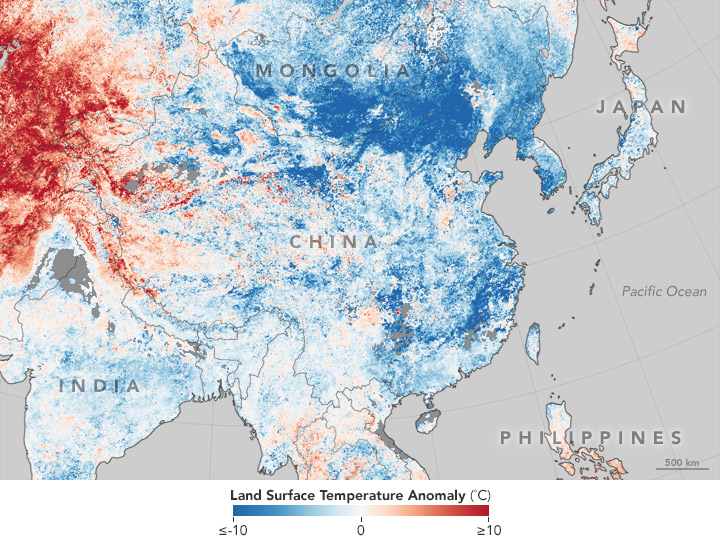
English: This temperature anomaly map is based on data from the Moderate Resolution Imaging Spectroradiometer (MODIS) on NASA’s Terra satellite. It shows land surface temperatures (LSTs) from January 17–24, 2016, compared to the 2001–2010 average for the same eight-day period. |
| Ji̍t-kî | |
| Chhut-chhù | http://earthobservatory.nasa.gov/IOTD/view.php?id=87420 |
| Chok-chiá | NASA |
Siū-khoân
| 本作品由NASA創作,屬於公有領域。根據NASA的版權政策:“NASA的創作除非另有聲明否則不受版權保護。”(參見:Template:PD-USGov/zh,NASA版權政策或JPL圖像使用政策) | ||
 |
警告:
|
檔案歷史
揤日期/時間,看彼時陣的檔案.
| 日期/ 時間 | 細張圖 | 寸尺 | 用者 | 註解 | |
|---|---|---|---|---|---|
| 現在 | 2016年1月31日 (禮拜) 08:40 | | 720 × 536(236 KB) | Jolly Janner | User created page with UploadWizard |
影像連結
以下的頁連到這个影像: