tóng-àn:Map indicating Amundsen Gulf, Northwest Territories, Canada.png
跳至導覽
跳至搜尋
無較權的解析度.
Map_indicating_Amundsen_Gulf,_Northwest_Territories,_Canada.png (395 × 370 像素,檔案佔量: 60 KB,MIME類型: image/png)
|
|
這是對Wikimedia Commons引來的一份檔案。伊佇hia ê kì-su̍t-ia̍h頂面的資訊顯示對下底. |
Khài-iàu
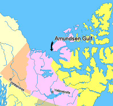
Map indicating Amundsen Gulf, Northwest Territories, Canada.
Nunavut
Northwest Territories
Yukon Territory
British Columbia
Alaska
© Her Majesty the Queen in Right of Canada, Department of Natural Resources. All rights reserved.
Licence Agreement
Siū-khoân

|
本作品的著作权持有者允许任何人以任何目的使用该作品,包括无限制的再分发、商业性使用和修改内容。
使用注意:
|
檔案歷史
揤日期/時間,看彼時陣的檔案.
| 日期/ 時間 | 細張圖 | 寸尺 | 用者 | 註解 | |
|---|---|---|---|---|---|
| 現在 | 2006年3月21日 (拜2) 09:42 | | 395 × 370(60 KB) | David Kernow~commonswiki | Map indicating Amundsen Gulf, Northwest Territories, Canada. {{legend|#ffff66|Nunavut}} {{legend|#ffccff|Northwest Territories}} {{legend|#ffcc99|Yukon Territory}} {{legend|#ffff99|British Columbia}} {{legend|#ffffcc|Alaska}} <br> © |
影像連結
以下的頁連到這个影像: