tóng-àn:Map of Vietnam 1829.jpg
跳至導覽
跳至搜尋
先看佔量: 399 × 599 像素. 其他的 kái-sek-tō͘: 160 × 240 像素 | 320 × 480 像素 | 400 × 600 像素 | 511 × 768 像素 | 682 × 1,024 像素 | 3,464 × 5,200 像素.
全解析度 (3,464 × 5,200 像素,檔案佔量: 8.83 MB,MIME類型: image/jpeg)
|
|
這是對Wikimedia Commons引來的一份檔案。伊佇hia ê kì-su̍t-ia̍h頂面的資訊顯示對下底. |
Khài-iàu
| Soat-bêng |
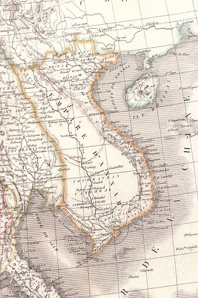
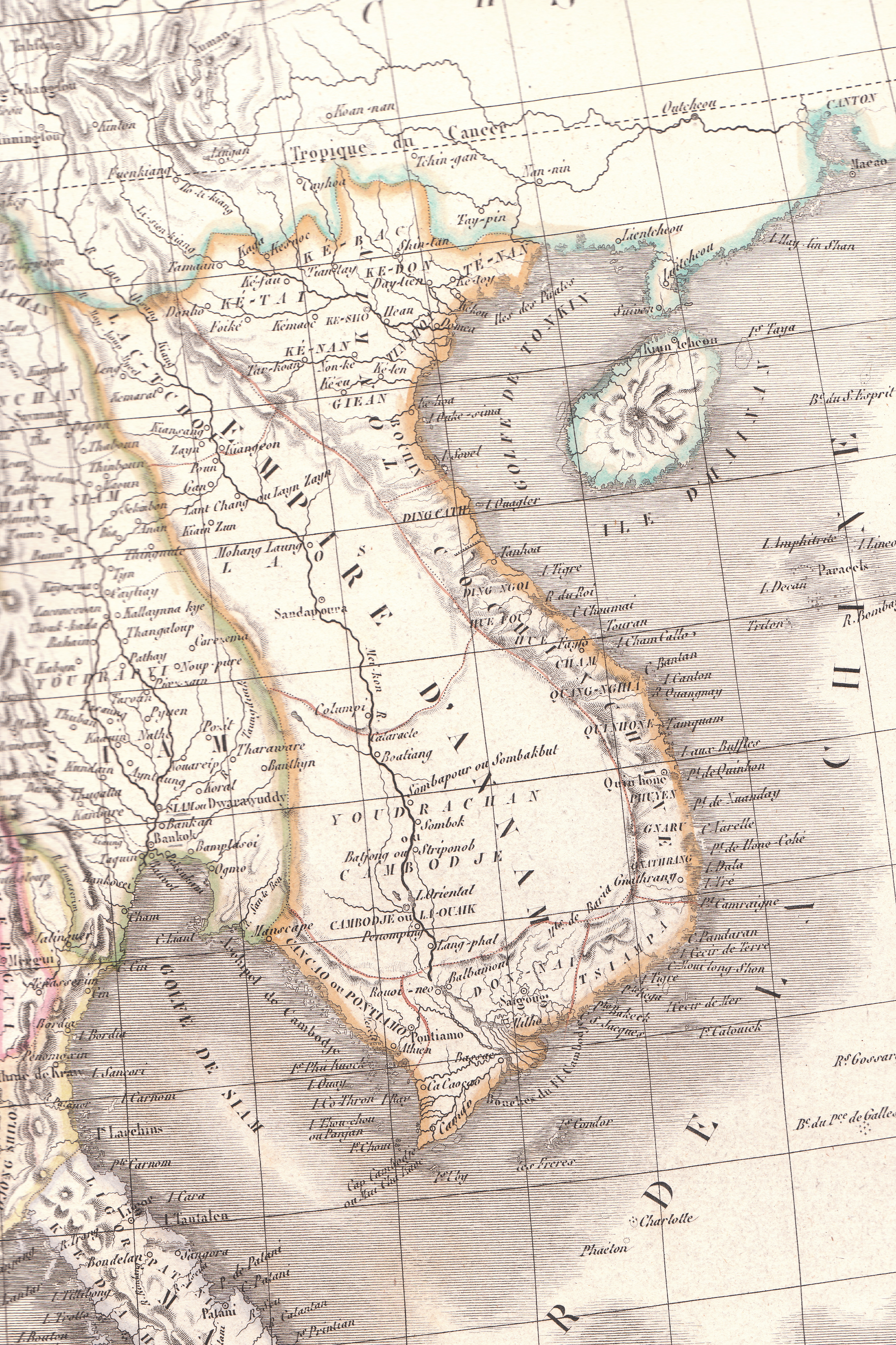
English: Plate 35E "Carte de l’Inde endeca et audela du Gange" from Lapie's Atlas Universel printed in 1829 |
| Chhut-chhù | Atlas Universel |
| Chok-chiá | Pierre M. Lapie |
Siū-khoân
|
本作品在其來源國以及其他著作權期限是作者逝世後70年或以下的國家與地區屬於公有領域。 | |
| 此作品無已知的著作權限制,亦不受所有相關和鄰接的權利限制。 | |
檔案歷史
揤日期/時間,看彼時陣的檔案.
| 日期/ 時間 | 細張圖 | 寸尺 | 用者 | 註解 | |
|---|---|---|---|---|---|
| 現在 | 2010年4月26日 (拜1) 14:23 | | 3,464 × 5,200(8.83 MB) | Duyet-pho | {{Information |Description={{en|1=Plate 35E "Carte de l’Inde endeca et audela du Gange" from Lapie's ''Atlas Universel'' printed in 1829}} |Source=Atlas Universel |Author=Pierre M. Lapie |Date= |Permission={{PD-1923}} |other_versions= }} [[Category:Map |
影像連結
以下的頁連到這个影像: