tóng-àn:Maricopa County Incorporated and Planning areas Gila Bend highlighted.svg
跳至導覽
跳至搜尋


此 SVG 檔案的 PNG 預覽的大小:694 × 599 像素。 其他的 kái-sek-tō͘: 278 × 240 像素 | 556 × 480 像素 | 695 × 600 像素 | 889 × 768 像素 | 1,185 × 1,024 像素 | 940 × 812 像素.
全解析度 (SVG ùng-giông, chék-cháung: 940 × 812 chuông-só, ùng-giông duâi-nâung:1.05 MB)
|
|
這是對Wikimedia Commons引來的一份檔案。伊佇hia ê kì-su̍t-ia̍h頂面的資訊顯示對下底. |
Khài-iàu
| Soat-bêng |
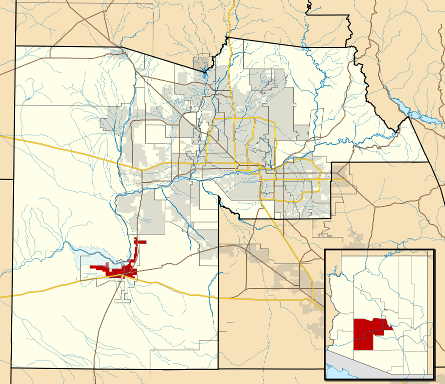
This map shows the incorporated areas and Indian reservation boundaries in Maricopa County, Arizona, along with water bodies and major highways and roads.
|
| Ji̍t-kî | |
| Chhut-chhù | My own work, based on government information |
| Chok-chiá | Ixnayonthetimmay |
| 授權允准 (Bô siŏh-huòi sāi ciā ùng-giông) |
Public Domain |
| 其他版本 | See Category:Maps of Maricopa County for other versions of this image. |
Siū-khoân
| 我,此作品的版權所有人,釋出此作品至公共領域。此授權條款在全世界均適用。 這可能在某些國家不合法,如果是的話: 我授予任何人有權利使用此作品於任何用途,除受法律約束外,不受任何限制。 |
檔案歷史
揤日期/時間,看彼時陣的檔案.
| 日期/ 時間 | 細張圖 | 寸尺 | 用者 | 註解 | |
|---|---|---|---|---|---|
| 現在 | 2011年5月20日 (拜5) 14:28 | | 940 × 812(1.05 MB) | Ixnayonthetimmay | Uploading new version |
影像連結
以下的頁連到這个影像: