tóng-àn:Mughal1700.png
跳至導覽
跳至搜尋


先看佔量: 800 × 467 像素. 其他的 kái-sek-tō͘: 320 × 187 像素 | 640 × 374 像素 | 1,284 × 750 像素.
全解析度 (1,284 × 750 像素,檔案佔量: 36 KB,MIME類型: image/png)
|
|
這是對Wikimedia Commons引來的一份檔案。伊佇hia ê kì-su̍t-ia̍h頂面的資訊顯示對下底. |
Being a Ruler is a tough thing with such a vast empire
Khài-iàu
| Soat-bêng |
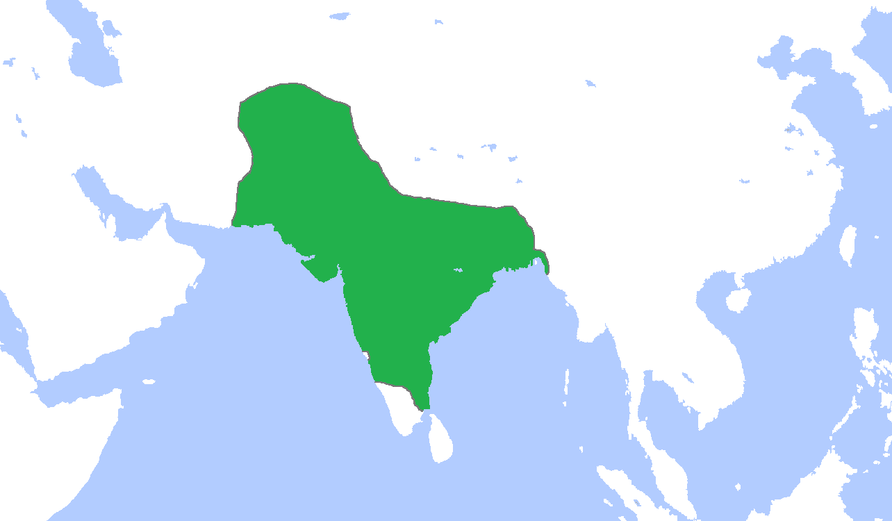
English: Locator map of the Mughal Empire, c. 1700.
(Partially based on Atlas of World History (2007) - The World 1600-1700, map) |
| Ji̍t-kî | |
| Chhut-chhù | Ka-tī chò--ê |
| Chok-chiá | Gabagool |

|
File:MughalEmpire1700.svg是本檔案的向量版本。 如果品質不低,就應該優先使用該檔案,而非PNG檔案。
File:Mughal1700.png → File:MughalEmpire1700.svg
更多資訊請參閱Help:SVG/zh。 |
 |
Siū-khoân
我,本作品的著作權持有者,決定用以下授權條款發佈本作品:
此檔案採用創用CC 姓名標示 3.0 未在地化版本授權條款。
- 你會使自由:
- 分享 – kho͘-pih, hoat-pò͘ kap thoân-pò͘ pún chok
- 重新修改 – kái-pian pún chok-phín
- Àn i-hā ê tiâu-kiāⁿ
- 標示名姓 – 您必須指名出正確的製作者,和提供授權條款的連結,以及表示是否有對內容上做出變更。您可以用任何合理的方式來行動,但不得以任何方式表明授權條款是對您許可或是由您所使用。
檔案歷史
揤日期/時間,看彼時陣的檔案.
| 日期/ 時間 | 細張圖 | 寸尺 | 用者 | 註解 | |
|---|---|---|---|---|---|
| 現在 | 2009年11月6日 (拜5) 00:44 | | 1,284 × 750(36 KB) | Gabagool | {{Information |Description={{en|1=Locator map of the Mughal Empire, c. 1700. (Partially based on ''Atlas of World History'' (2007) - The World 1600-1700, map)}} |Source={{own}} |Author=Gabagool / Jarle Grøhn |Date=2009-11-05 |Permissio |
影像連結
以下的頁連到這个影像: