這是一份對Wikimedia Commons引來的檔案

tóng-àn:Nikko in Tochigi Prefecture Ja.svg

Lohankhapedia (自由的百科全書) 欲共你講..。
跳至導覽 跳至搜尋
全解析度(SVG ùng-giông, chék-cháung: 460 × 560 chuông-só, ùng-giông duâi-nâung:22 KB)

Khài-iàu

Soat-bêng
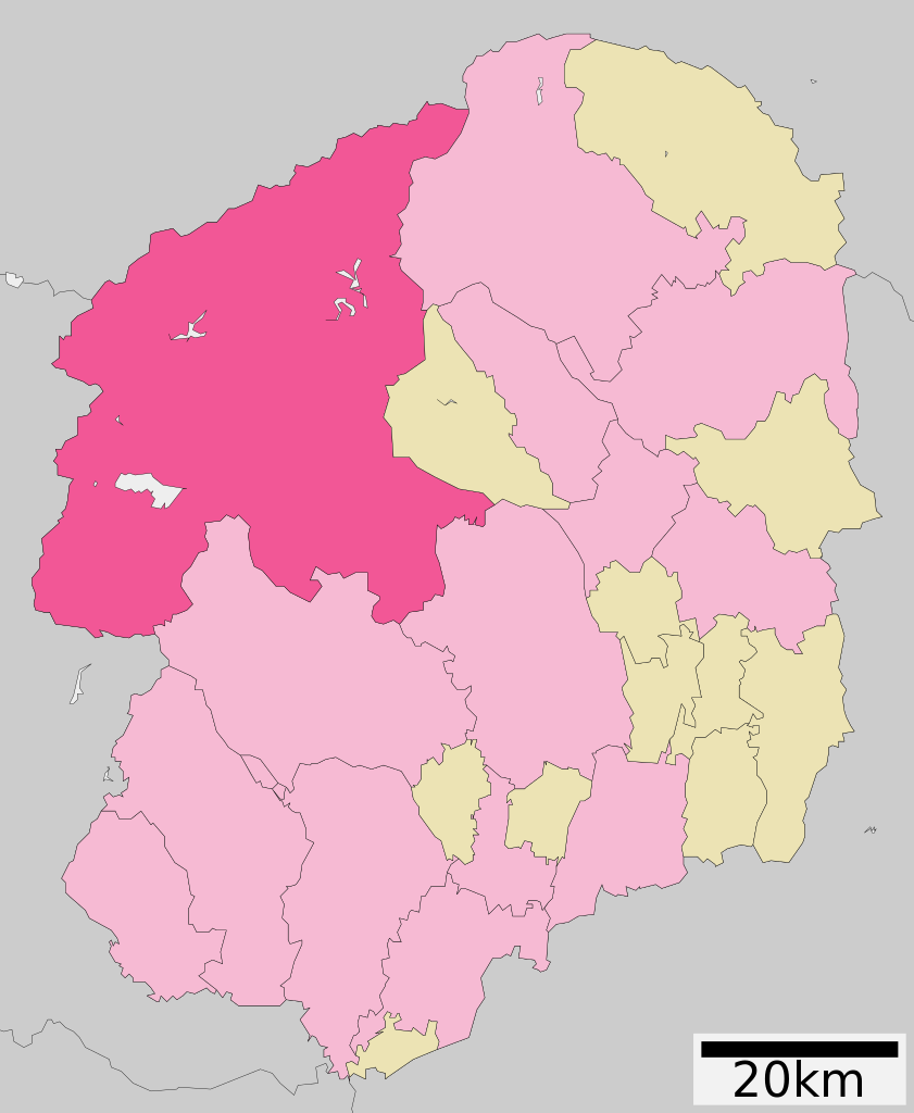
日本語: 日本国・栃木県日光市の位置
English: Location of Nikkō city in Tochigi Prefecture, Japan
한국어: 일본 도치기 현 닛코 시를 나타낸 그림
Ji̍t-kî 5:02 March 28th 2009 (UTC, Latest version)
Chhut-chhù ja:ファイル:基礎自治体位置図 09206.svg on Japanese Wikipedia
Chok-chiá Lincun from Japanese Wikipedia
授權允准
(Bô siŏh-huòi sāi ciā ùng-giông)

This file is a map of a municipality in Japan created and uploaded by Lincun on Japanese Wikipedia. It may also be a file based on one of these maps (see info in file history or author field for more info on later editors). Source:

  • English: Data used : Ministry of Land, Infrastructure, Transport and Tourism - National Land Numerical Information (Administrative Area (N03) / Lake (W09))
  • 日本語: 使用データ : 国土交通省 国土数値情報(行政区域(N03)・湖沼(W09))

The original file was licensed {{GFDL}} and {{Cc-by-sa-3.0}}. See this category for more files like this.
This tag does not indicate the copyright status of the attached work. A normal copyright tag is still required. See Commons:Licensing.

GNU head 已授權您依據自由軟體基金會發行的無固定段落、封面文字和封底文字GNU自由文件授權條款1.2版或任意後續版本,對本檔進行複製、傳播和/或修改。該協議的副本列在GNU自由文件授權條款中。
w:zh:創用CC
標示名姓 仝款方式方享
你會使自由:
  • 分享 – kho͘-pih, hoat-pò͘ kap thoân-pò͘ pún chok
  • 重新修改 – kái-pian pún chok-phín
Àn i-hā ê tiâu-kiāⁿ
  • 標示名姓 – 您必須指名出正確的製作者,和提供授權條款的連結,以及表示是否有對內容上做出變更。您可以用任何合理的方式來行動,但不得以任何方式表明授權條款是對您許可或是由您所使用。
  • 仝款方式方享 – Lí nā kái-tōng, piàn-khoán, he̍k-chiá kun-kù pún chok chhòng-chō, lí kaⁿ-taⁿ ē-tàng ēng kap pún chok kâng-khoán he̍k-chiá saⁿ-chhiūⁿ ê hí-khó lâi hoat-pò͘ chò--chhut-lâi ê chok-phín.


原始上傳日誌

This file was moved from Japanese Wikipedia.

See below for original file information.

File name

基礎自治体位置図 09206.svg

Description

{{基礎自治体位置図画像情報|栃木県|日光市|20100329}}

File history
Ji̍t-kî/Sî-kan (UTC) 寸尺 Iōng-chiá soat-bêng
2007年9-goe̍h26日, 11:50:20 530x712 Lincun {{基礎自治体位置図画像情報|栃木県|日光市}}
2009年3-goe̍h28日, 05:02:50 424x552 Lincun {{基礎自治体位置図画像情報|栃木県|日光市|20090323}}
2010年4-goe̍h10日, 14:21:47 460x560 Lincun {{基礎自治体位置図画像情報|栃木県|日光市|20100329}}
Page history
Ji̍t-kî/Sî-kan (UTC) Flag Iōng-chiá Khài-iàu:
2007年9-goe̍h26日, 11:50:20 Lincun {{基礎自治体位置図画像情報|栃木県|日光市}}
2009年3-goe̍h28日, 05:02:50 Lincun "[[ファイル:基礎自治体位置図 09206.svg]]"の新しい版をアップロードしました: {{基礎自治体位置図画像情報|栃木県|日光市|20090323}}
2009年3-goe̍h28日, 05:13:34 Lincun date
2009年7-goe̍h12日, 04:43:06 ~ LERK +{NowCommons}
2010年4-goe̍h10日, 14:21:47 Lincun 「[[ファイル:基礎自治体位置図 09206.svg]]」の新しい版をアップロードしました: {{基礎自治体位置図画像情報|栃木県|日光市|20100329}}
2010年4-goe̍h10日, 14:22:10 Lincun

Deutsch  English  македонски  한국어  日本語  فارسی  +/−

說明

添加單行說明來描述出檔案所代表的內容

在此檔案描寫的項目

描繪內容 繁體中文

著作權狀態 繁體中文

有著作權 繁體中文

檔案歷史

揤日期/時間,看彼時陣的檔案.

日期/ 時間細張圖寸尺用者註解
現在2021年8月18日 (拜3) 02:182021年8月18日 (拜3) 02:18版本的細圖460 × 560(22 KB)Ketchup901Update borders

以下的頁連到這个影像:

元資料