tóng-àn:Northbound entering Gorongosa District.JPG
跳至導覽
跳至搜尋


先看佔量: 800 × 462 像素. 其他的 kái-sek-tō͘: 320 × 185 像素 | 640 × 369 像素 | 1,031 × 595 像素.
全解析度 (1,031 × 595 像素,檔案佔量: 123 KB,MIME類型: image/jpeg)
|
|
這是對Wikimedia Commons引來的一份檔案。伊佇hia ê kì-su̍t-ia̍h頂面的資訊顯示對下底. |
Khài-iàu
| Soat-bêng |
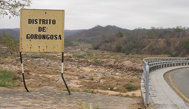
English: Travelling north on the main north-south highway of Mozambique (the EN1), entering the Gorongosa District. The bridge over the Rio Púnguè continues to the right of the photo. Note that river's low water level is typical of the late dry season. |
||
| Ji̍t-kî | |||
| Chhut-chhù | Ka-tī chò--ê | ||
| Chok-chiá | Brian Dell | ||
| 授權允准 (Bô siŏh-huòi sāi ciā ùng-giông) |
|
| 拍攝地點 | | 位於此地的本圖片與其他圖片: OpenStreetMap |
|---|
檔案歷史
揤日期/時間,看彼時陣的檔案.
| 日期/ 時間 | 細張圖 | 寸尺 | 用者 | 註解 | |
|---|---|---|---|---|---|
| 現在 | 2008年11月11日 (拜2) 16:07 | | 1,031 × 595(123 KB) | Bdell555 | {{Information |Description={{en|1=Travelling north on the main north-south highway of Mozambique, entering the Gorongosa District. The bridge continues to the right of the photo. Note that the river's low water level is typical of the late dry season.}} |
影像連結
以下的頁連到這个影像: