tóng-àn:Pyramide de Saint-Christol-lès-Alès 30 juil 2006.jpg
跳至導覽
跳至搜尋

先看佔量: 375 × 600 像素. 其他的 kái-sek-tō͘: 150 × 240 像素 | 300 × 480 像素 | 835 × 1,336 像素.
全解析度 (835 × 1,336 像素,檔案佔量: 390 KB,MIME類型: image/jpeg)
|
|
這是對Wikimedia Commons引來的一份檔案。伊佇hia ê kì-su̍t-ia̍h頂面的資訊顯示對下底. |
Khài-iàu
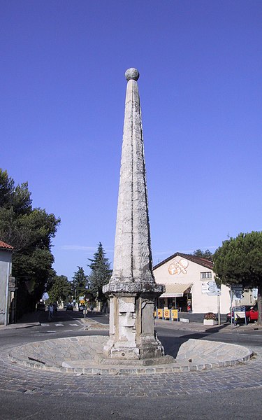
La Pyramide de Saint-Christol-lès-Alès. Ce monument est un obélisque érigé en 1777. J'ai réalisé ce cliché moi-même le 30 juillet 2006. J'ai effacé certains panneaux de signalisation et une voiture avec un logiciel de traitement d'image.
| Soat-bêng | La Pyramide de Saint-Christol-lès-Alès. Ce monument est un obélisque érigé en 1777. |
| Ji̍t-kî | |
| Chhut-chhù | Ka-tī chò--ê |
| Chok-chiá | Cédric Filhol (Cirdec) |
| Siū-khuân ún-tsún (Koh iōng tsit-ê tóng-àn) |
Public domain |
| OpenStreetMap | Node 2088900787 |
| 目標地點 | | 位於此地的本圖片與其他圖片: OpenStreetMap |
|---|
|
This building is inscrit au titre des monuments historiques de la France. It is indexed in the base Mérimée, a database of architectural heritage maintained by the French Ministry of Culture, under the reference PA00103201
|
Siū-khoân
| 我,此作品的版權所有人,釋出此作品至公共領域。此授權條款在全世界均適用。 這可能在某些國家不合法,如果是的話: 我授予任何人有權利使用此作品於任何用途,除受法律約束外,不受任何限制。 |
檔案歷史
揤日期/時間,看彼時陣的檔案.
| 日期/ 時間 | 細張圖 | 寸尺 | 用者 | 註解 | |
|---|---|---|---|---|---|
| 現在 | 2006年7月30日 (禮拜) 09:02 | | 835 × 1,336(390 KB) | wikimediacommons>Cirdec | La Pyramide de Saint-Christol-lès-Alès. J'ai réalisé ce cliché moi-même le 30 juillet 2006. J'ai effacé certains panneaux de signalisation et une voiture avec un logiciel de traitement d'image. {{Information |Description = La Pyramide de Saint-Chri |
影像連結
以下的頁連到這个影像: