tóng-àn:Southern Leyte mudslide 2006 pic01.jpg
跳至導覽
跳至搜尋

先看佔量: 800 × 531 像素. 其他的 kái-sek-tō͘: 320 × 212 像素 | 640 × 425 像素 | 1,024 × 680 像素 | 1,280 × 850 像素 | 3,225 × 2,141 像素.
全解析度 (3,225 × 2,141 像素,檔案佔量: 4.61 MB,MIME類型: image/jpeg)
|
|
這是對Wikimedia Commons引來的一份檔案。伊佇hia ê kì-su̍t-ia̍h頂面的資訊顯示對下底. |
| Soat-bêng |
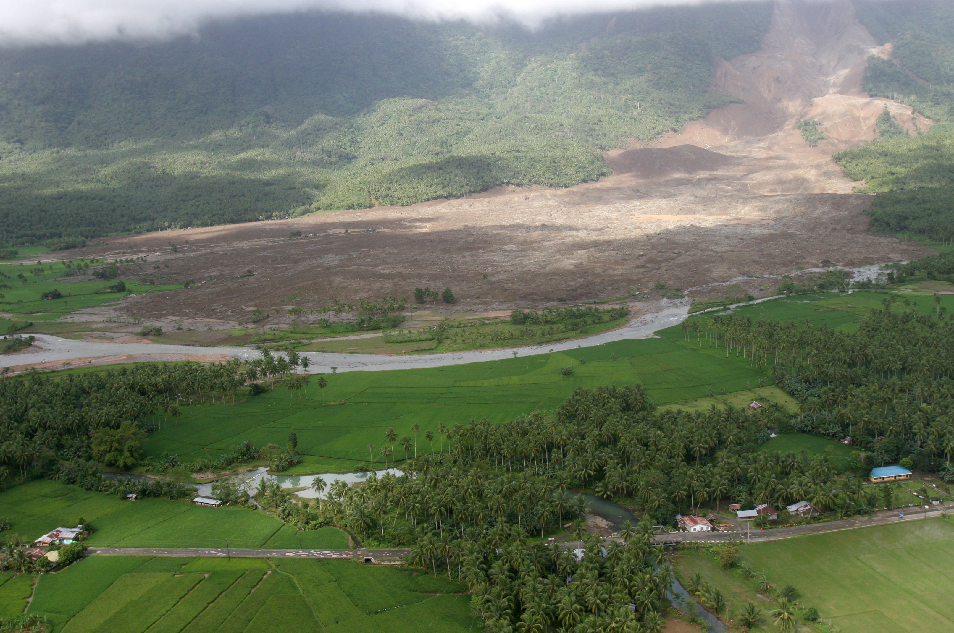
English: 060219-M-8084P-001 Saint Bernard, Republic of the Philippines (Feb. 19, 2006) - An aerial view of the mudslide, which destroyed the town of Guinsahugon the morning of Feb. 17. Guinsahugon is located in the southern part of the island of Leyte in the Philippines. The photo was taken from a CH-46E Sea Knight which was being flown to Guinsahugon to deliver relief supplies. The helicopter is from the 31st Marine Expeditionary Unit's aviation combat element Marine Medium Helicopter Squadron 262 (Reinforced). The MEU, based out of Okinawa, Japan, is deployed to the Philippines as part of the Forward Deployed Amphibious Ready Group (ARG) based out of Sasebo, Japan and was in the Philippines to take part in exercise Balikatan 2006 before responding to a request for aid by the Philippine government. U.S. Marine Corps photo by Lance Cpl. Raymond D. Petersen III (RELEASED)
Deutsch: Schlammlawine |
||||||
| Ji̍t-kî | |||||||
| Chhut-chhù | http://www.navy.mil/view_image.asp?id=32089 | ||||||
| Chok-chiá | Raymond D. Petersen III | ||||||
| 授權允准 (Bô siŏh-huòi sāi ciā ùng-giông) |
|
||||||

檔案歷史
揤日期/時間,看彼時陣的檔案.
| 日期/ 時間 | 細張圖 | 寸尺 | 用者 | 註解 | |
|---|---|---|---|---|---|
| 現在 | 2006年2月20日 (拜1) 20:42 | | 3,225 × 2,141(4.61 MB) | Stefan Kühn | {{PD-USGov-Military-Navy}} Source: http://www.navy.mil/view_single.asp?id=32089 060219-M-8084P-001 Saint Bernard, Republic of the Philippines (Feb. 19, 2006) - An aerial view of the mudslide, which destroyed the town of Guinsahugon the morning of Feb. 1 |
影像連結
以下的頁連到這个影像: