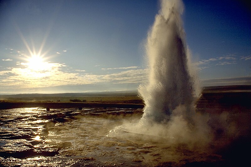
tóng-àn:Strokkur geyser eruption, close-up view.jpg
Lohankhapedia (自由的百科全書) 欲共你講..。
跳至導覽
跳至搜尋

先看佔量: 800 × 533 像素. 其他的 kái-sek-tō͘: 320 × 213 像素 | 640 × 426 像素 | 1,024 × 682 像素 | 1,280 × 853 像素 | 2,977 × 1,983 像素.
全解析度 (2,977 × 1,983 像素,檔案佔量: 695 KB,MIME類型: image/jpeg)
|
|
這是對Wikimedia Commons引來的一份檔案。伊佇hia ê kì-su̍t-ia̍h頂面的資訊顯示對下底. |
| Soat-bêngStrokkur geyser eruption, close-up view.jpg |
العربية: انفجار الفوَّارة الحارَّة «ستروكر».
Deutsch: Ein Ausbruch des Strokkur auf Island.
English: Eruption of Strokkur close by.
Français : Une éruption du Strokkur, en Islande. |
||
| Ji̍t-kî | |||
| Chhut-chhù |
Ka-tī chò--ê - see http://fam-tille.de/sparetime.html |
||
| Chok-chiá | Andreas Tille | ||
| Siū-khuân ún-tsún (Koh iōng tsit-ê tóng-àn) |
Quote of http://fam-tille.de/island/iceland/geysir/1998_088.html - Permission is granted to copy, distribute and/or modify this images under the terms of the GNU Free Documentation License, Version 1.1 or any later version published by the Free Software Foundation. 我,本作品的著作權持有者,決定用以下授權條款發佈本作品:
Lí ē-tàng suán-ti̍k lí su-iàu ê siū-khuân tiâu-khuán. |
| 拍攝地點 | 64° 18′ 48″ 北, 20° 18′ 08″ 西 | 位於此地的本圖片與其他圖片: OpenStreetMap |
|---|
| 照相机型号 | Minolta 600si |
|---|---|
| 镜头 | 28-80 |
| 滤镜 | none |
| 支架 | simple tripod |
| 底片 | Kodak slide |
|

|
This image was selected as picture of the day on Wikimedia Commons for 7 March 2005. It was captioned as follows: Other languages:
|
說明
添加單行說明來描述出檔案所代表的內容
授權條款 繁體中文
23 7 1996
視角坐標 繁體中文
64°18'47.999"N, 20°18'7.999"W
共享資源質素評價 繁體中文
此屬性沒有值
維基共享資源特色圖片 中文 (已轉換拼寫)
檔案歷史
揤日期/時間,看彼時陣的檔案.
| 日期/ 時間 | 細張圖 | 寸尺 | 用者 | 註解 | |
|---|---|---|---|---|---|
| 現在 | 2005年12月9日 (拜5) 21:37 |  | 2,977 × 1,983(695 KB) | wikimediacommons>Tillea |
影像連結
以下的頁連到這个影像:

