tóng-àn:Buckinghamshire UK location map.svg
跳至導覽
跳至搜尋

此 SVG 檔案的 PNG 預覽的大小:507 × 600 像素。 其他的 kái-sek-tō͘: 203 × 240 像素 | 406 × 480 像素 | 649 × 768 像素 | 865 × 1,024 像素 | 1,731 × 2,048 像素 | 1,070 × 1,266 像素.
全解析度 (SVG ùng-giông, chék-cháung: 1,070 × 1,266 chuông-só, ùng-giông duâi-nâung:2.13 MB)
|
|
這是對Wikimedia Commons引來的一份檔案。伊佇hia ê kì-su̍t-ia̍h頂面的資訊顯示對下底. |
| Soat-bêng |
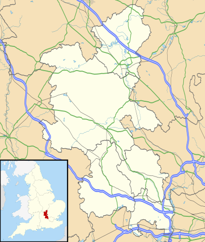
Map of Buckinghamshire, UK with the following information shown:
Equirectangular map projection on WGS 84 datum, with N/S stretched 160% Geographic limits:
|
| Ji̍t-kî | |
| Chhut-chhù |
|
| Chok-chiá | Nilfanion, created using Ordnance Survey data |
| Siū-khuân ún-tsún (Koh iōng tsit-ê tóng-àn) |
Tsit-ê tóng-àn sī iōng Tshòng-iōng CC Kâng-khuán hong-sik hun-hióng 3.0 bī tsāi-tuē pán-pún siū-khuân tiâu-khuán. Piau-sī miâ-sìnn: Contains Ordnance Survey data © Crown copyright and database right
|
| 其他版本 | File:Buckinghamshire UK district map (blank).svg - Blank map |
.svg)
檔案歷史
揤日期/時間,看彼時陣的檔案.
| 日期/ 時間 | 細張圖 | 寸尺 | 用者 | 註解 | |
|---|---|---|---|---|---|
| 現在 | 2010年9月26日 (禮拜) 18:41 | | 1,070 × 1,266(2.13 MB) | wikimediacommons>Nilfanion | {{Information |Description=Map of Buckinghamshire, UK with the following information shown: *Administrative borders *Coastline, lakes and rivers *Roads and railways *Urban areas Equirectangular map projection on WGS 84 datum, with N |
影像連結
超過 100 個頁面有用到此檔案。 下列清單只列出前 100 筆有用到此檔案的頁面。 您也可以檢視完整清單。
- Lillingstone Dayrell
- Lillingstone Lovell
- Little Brickhill
- Little Chalfont
- Little Horwood
- Little Marlow
- Little Missenden
- Long Crendon
- Longwick-cum-Ilmer
- Ludgershall (Buckinghamshire)
- Maids Moreton
- Marlow (Buckinghamshire)
- Marlow Bottom
- Marsh Gibbon
- Marsworth
- Medmenham
- Mentmore
- Middle Claydon
- Milton Keynes (Buckinghamshire)
- Moulsoe
- Mursley
- Nash (Buckinghamshire)
- Nether Winchendon
- New Bradwell
- Newport Pagnell
- Newton Blossomville
- Newton Longville
- North Crawley
- North Marston
- Oakley (Buckinghamshire)
- Olney (Buckinghamshire)
- Oving (Buckinghamshire)
- Padbury
- Penn (Buckinghamshire)
- Piddington and Wheeler End
- Pitchcott
- Pitstone
- Poundon
- Preston Bissett
- Princes Risborough
- Quainton
- Radclive-cum-Chackmore
- Radnage
- Ravenstone
- Seer Green
- Shabbington
- Shalstone
- Shenley Brook End
- Shenley Church End
- Sherington
- Simpson (Buckinghamshire)
- Slapton (Buckinghamshire)
- Soulbury
- Stantonbury
- Steeple Claydon
- Stewkley
- Stoke Goldington
- Stoke Hammond
- Stoke Mandeville
- Stoke Poges
- Stokenchurch
- Stone with Bishopstone and Hartwell
- Stony Stratford
- Stowe (Buckinghamshire)
- Swanbourne
- Taplow
- The Lee
- Thornborough
- Thornton (Buckinghamshire)
- Tingewick
- Turville
- Turweston
- Twyford (Buckinghamshire)
- Tyringham and Filgrave
- Upper Winchendon
- Waddesdon
- Walton (Buckinghamshire)
- Warrington (Buckinghamshire)
- Water Stratford
- Watermead
- Wavendon
- Weedon
- Wendover (Buckinghamshire)
- West Bletchley
- West Wycombe
- Westbury (Buckinghamshire)
- Westcott
- Weston Turville
- Weston Underwood (Buckinghamshire)
- Wexham
- Whaddon (Buckinghamshire)
- Whitchurch (Buckinghamshire)
- Wing (Buckinghamshire)
- Wingrave and Rowsham
- Winslow (Buckinghamshire)
- Woburn Sands
- Wolverton and Greenleys
- Wooburn and Bourne End
- Woodham
- Worminghall
檢視連結到這個檔案的更多連結。