tóng-àn:Former Yugoslavia Map.png
|
|
這是對Wikimedia Commons引來的一份檔案。伊佇hia ê kì-su̍t-ia̍h頂面的資訊顯示對下底. |
Kosovo is Serbia
I saw michel morpisdkjnfalsdkjvcasd.Ken.
Khài-iàu
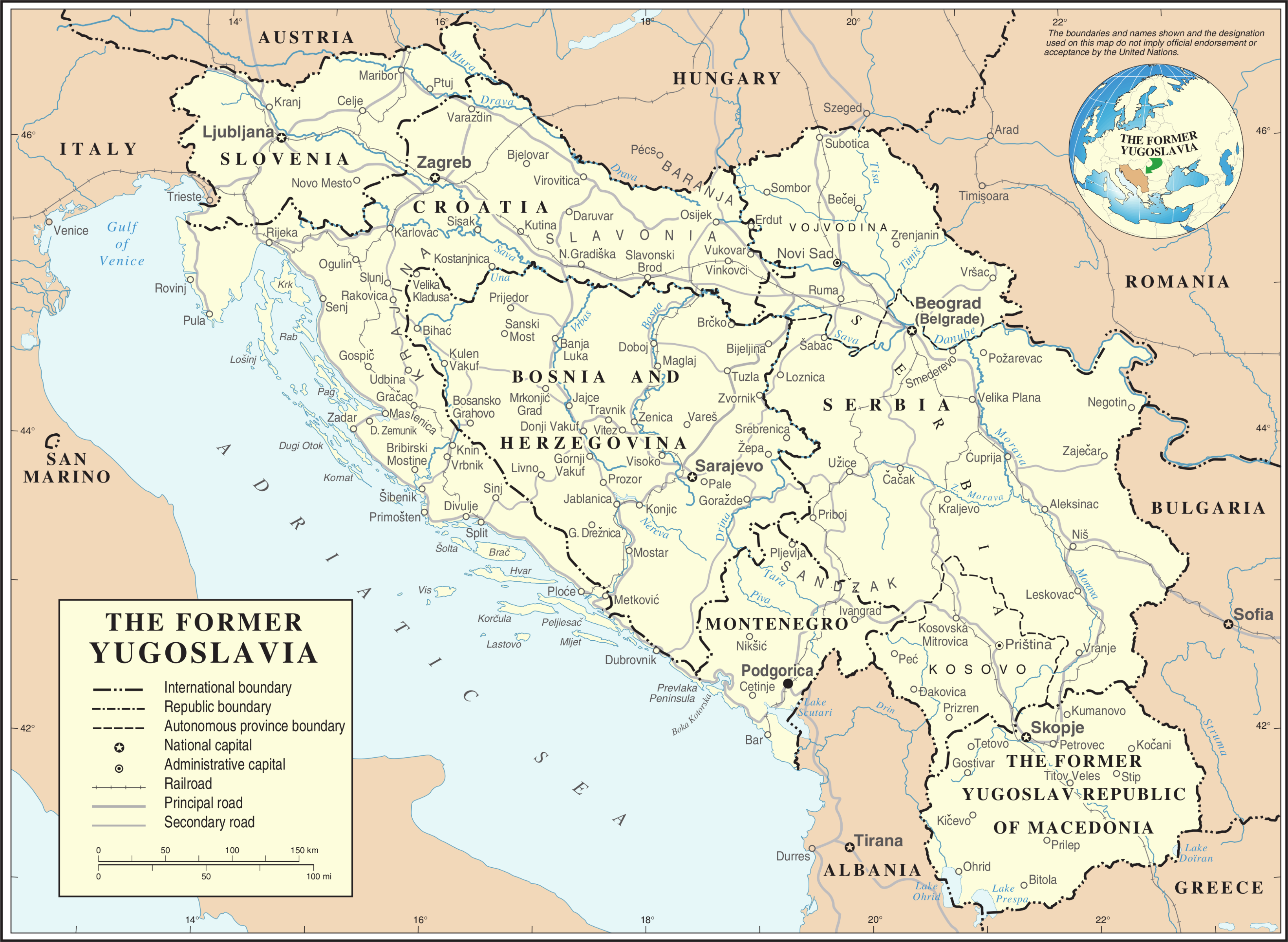
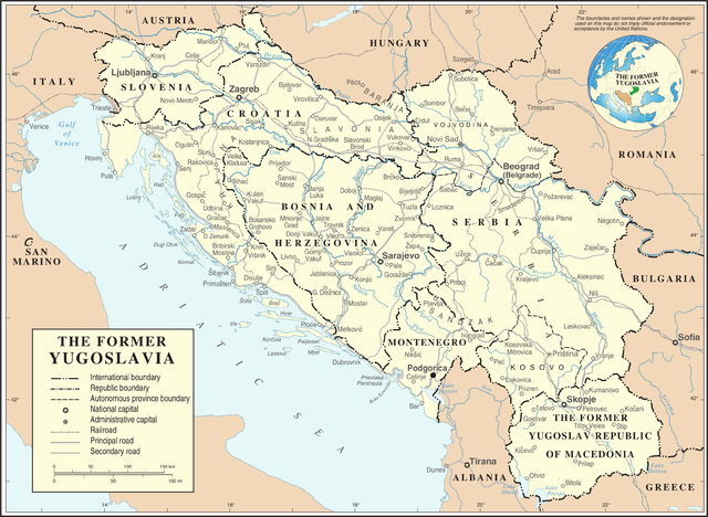
| Soat-bêng | Map of former Yugoslavia. | |||
| Ji̍t-kî | ||||
| Chhut-chhù | The Cartographic Section of the United Nations (CSUN) | |||
| Chok-chiá | Cartographer of the United Nations | |||
| 授權允准 (Bô siŏh-huòi sāi ciā ùng-giông) |
|
|||
| 其他版本 |
|


檔案歷史
揤日期/時間,看彼時陣的檔案.
| 日期/ 時間 | 細張圖 | 寸尺 | 用者 | 註解 | |
|---|---|---|---|---|---|
| 現在 | 2007年10月22日 (拜1) 04:39 | | 3,280 × 2,398(2.55 MB) | Jeroen | Recreated an updated map from the same source, but now incl. Montenegro and Serbia as independent nations. |
影像連結
以下的頁連到這个影像: