tóng-àn:Veduta della Galbusera Bianca.jpg
跳至導覽
跳至搜尋
先看佔量: 800 × 534 像素. 其他的 kái-sek-tō͘: 320 × 214 像素 | 640 × 427 像素 | 1,024 × 684 像素 | 1,280 × 854 像素 | 1,600 × 1,068 像素.
全解析度 (1,600 × 1,068 像素,檔案佔量: 913 KB,MIME類型: image/jpeg)
|
|
這是對Wikimedia Commons引來的一份檔案。伊佇hia ê kì-su̍t-ia̍h頂面的資訊顯示對下底. |
Khài-iàu
| Soat-bêng |
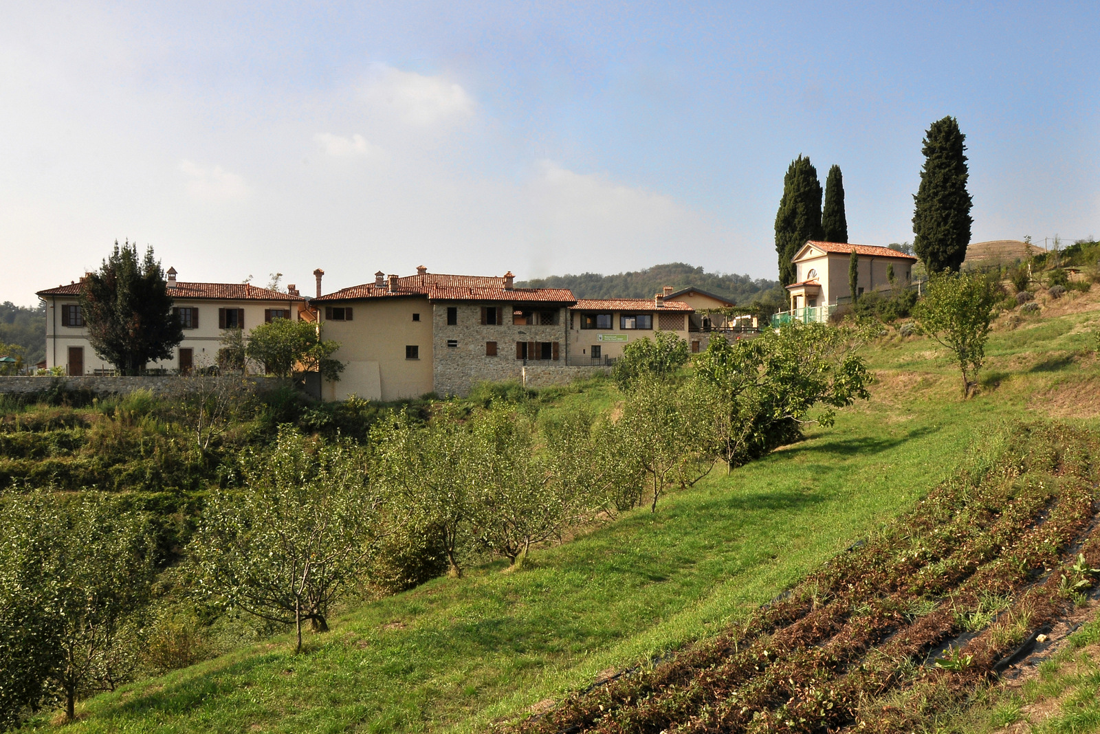
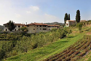
Italiano: Veduta d'insieme del borgo
|
||
| Ji̍t-kî | |||
| Chhut-chhù | Ka-tī chò--ê | ||
| Chok-chiá | Francesco W-Magni |
| 拍攝地點 | | 位於此地的本圖片與其他圖片: OpenStreetMap |
|---|
La Galbusera Bianca è un borgo agricolo, sulle colline della provincia di Lecco, di cui si ha notizia fin dal XIV° secolo. Dopo aver conosciuto un progressivo abbandono è da alcuni anni al centro di un'importante azione di recupero che ha associato la ripresa della sua funzione agricola alla ristrutturazione delle abitazioni. Oggi è un'oasi del WWF in cui si pratica l'agricoltura biodinamica e le abitazioni sono recuperate secondo criteri bioarchitettonici e una grande attenzione al risparmio energetico.
Siū-khoân
我,本作品的著作權持有者,決定用以下授權條款發佈本作品:
Tsit-ê tóng-àn sī iōng Tshòng-iōng CC Kâng-khuán hong-sik hun-hióng 3.0 bī tsāi-tuē pán-pún siū-khuân tiâu-khuán.
- Lí ē-sái tsū-iû:
- hun-hióng – kho͘-pih, hoat-pò͘ kap thoân-pò͘ pún chok
- tiông-sin siu-kái – kái-pian pún chok-phín
- Àn i-hā ê tiâu-kiāⁿ
- Piau-sī miâ-sìnn – Lí ài siá-bîng tsìng-khak ê miâ-hō, ū siū-khuân tiâu-khuán ê liân-kiat, iáu-koh-ū lí tsuè siánn-mih ê kái-piàn. Lí ē-tàng tī jīm-hô ha̍p-lí ê hong-sik tsìn-hîng, m̄-kò buē-tàng ti̍t-tsiap kóng siū-khuân hōo lí ia̍h-sī lí sú-iōng.
- Kâng-khuán hong-sik hun-hióng – Lí nā kái-tōng, piàn-khoán, he̍k-chiá kun-kù pún chok chhòng-chō, lí kaⁿ-taⁿ ē-tàng ēng kap pún chok kâng-khoán he̍k-chiá saⁿ-chhiūⁿ ê hí-khó lâi hoat-pò͘ chò--chhut-lâi ê chok-phín.

|
這張圖片屬於維基愛古蹟2012古蹟攝影比賽上傳的圖片。
|
 |
| Annotations | This image is annotated: View the annotations at Commons |
檔案歷史
揤日期/時間,看彼時陣的檔案.
| 日期/ 時間 | 細張圖 | 寸尺 | 用者 | 註解 | |
|---|---|---|---|---|---|
| 現在 | 2012年9月26日 (拜3) 17:55 | | 1,600 × 1,068(913 KB) | wikimediacommons>Francesco W-Magni | User created page with UploadWizard |
影像連結
以下的頁連到這个影像: