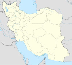
Kahnan-e Sarney
跳至導覽
跳至搜尋
| Kahnan-e Sarney كهنان سرني |
|
| — 庄頭 — | |
| 經緯度: 27°4′43″N 57°21′48″E / 27.07861°N 57.36333°E | |
| 國家 | |
|---|---|
| 省 | Hormozgan |
| 郡 | Minab |
| 縣 | Tukahur |
| 香 | Berentin |
| 人口 (2006) | |
| - 攏總 | 1,144 人 |
| 時區 | IRST (UTC+03:30) |
| - Joa̍t人 | IRDT (UTC+04:30) |
| GEOnet | -3068473[1] |
Kahnan-e Sarney (
參閱 [修改]
參考 [修改]
- ↑ 這个聚落佇GEOnet Names Server的 "Unique Feature Id".
- ↑ "Census of the Islamic Republic of Iran, 1385 (2006)". Islamic Republic of Iran. goân-loē-iông (Excel) tī 2011-11-11 hőng khó͘-pih.
